
Paper maps as backup for when the network is down
Stumbled across this picture of a helicopter crew surveying flooding along the Elbe while reading the news this morning:
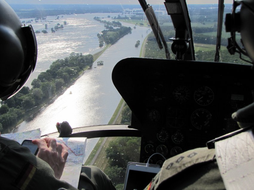
Helicopter cockpit with maps
As far as I am concerned this is a perfect illustration of the fact that paper maps have been relegated to being a backup solution for when the battery is empty or the cellular network is down (guess as a helicopter pilot you can’t really afford this). Also amazing how much the military (or paramilitary, not really clear from the picture if this a federal police or an army helicopter) seems to rely on of the shelf consumer technology these days.